Freshwater Environments
The water cycle
The water cycle is a closed cycle, which means there are no inputs or outputs. Water is simply transferred and stored within it. The animation below shows the important transfers within the water cycle. Can you spot some of the storages?
THE DRAINAGE BASIN
The drainage basin is an area of land that is drained by a river and its tributaries. It includes many characteristics and features. The following song will help you learn its features.
|
Transfers
Evaporation - the turning of a water into a gas Transpiration - the turning of water from vegetation into a gas Condensation- the turning of water vapour into a liquid Precipitation - rain, snow, amd hail Infiltration - the movement of water down into the soil Surface run-off - the movement of water over the ground |
|

|

Pop-up drainage basin
|

River Research Assignment
|
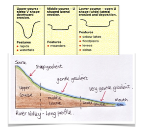
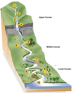
The features of a river
As water travels from source to mouth the river channel changes and so does its environment. The river has distinctive features at different stages of its course. In the upper course the river is narrow and rocky with v-shaped valleys, waterfalls and rapids. In the middle course the river is wider and deeper, faster flowing and a floodplain has formed. In the lower course the river is at its widest and deepest. The river flows fast and meanders and ox-bow lakes form. At the mouthrivers form either estuaries or deltas.
|
|
|

|

Ronnie the raindrop by Tony Cassidy
|
River processes
The river's main role is to erode and transport load from the upper course to the mout and in doing so it supplies vital minerals to ocean. With the help of weathering, rivers erode through four main processes. The bed and bank are erodes through hydraulic action, abrasion and solution. Bedload is eroded through the process of attrition. The river then transports its through four main processes, traction and saltation describes how bedload is transported and suspension and solution describe how suspended load is transported.
|
|
|
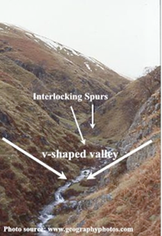
The upper course and its landforms
The source and upper course are located in upland areas, with rivers feeding from upland marshes, forests and glaciers. The river vertically erodes because it has a lot of energy. This energy creates narrow rocky streams surrounded by steep v-shaped valleys. In places the erosion creates steps in the river and rapids and waterfalls form.
V-shaped Valleys
|
|
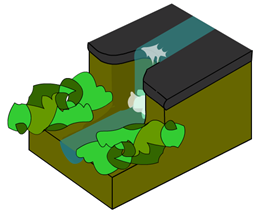
Waterfalls
Cleo Resources: Waterfall and Gorge Formation
|
|
|
TIP: Always use the term hydraulic action to explain erosion with waterfalls

|

In-class Waterfall Assessment
|
The Middle and Lower course Landforms
As the river flows downstream the channel becomes wider and deeper and less rocky. As a result the river flows faster. The river erodes more on the sides (lateral erosion) and so a number of landforms develop, including meanders, levees and floodplains. the following emaze presentation provides and excellent introduction.
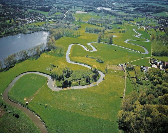
The River Dijle, Heverlee, Belgium
Natural Rivers change their course frequently, meanders develop and then change location and ox-bow lakes form. Over time this movement of meanders helps create floodplains. Floodplains also form from the constant deposition of sediment from flood events. The flowing image links to an animation of the River Danube.
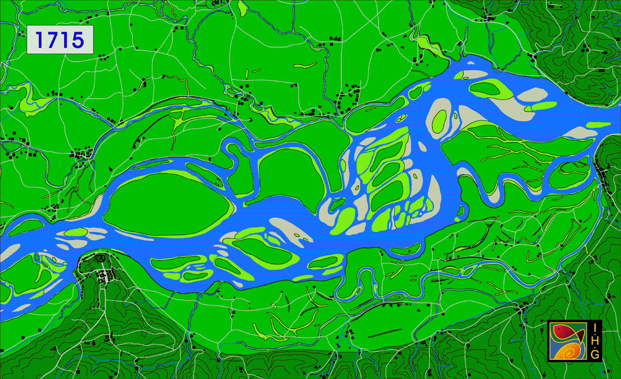
River Danube Animation
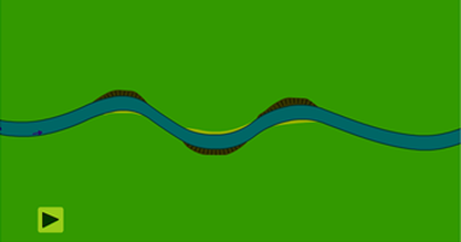
Meander Formation
|
|
Cleo Resources: Meander Formation
|
Year 7 Geography Fieldwork on the River Dijle
As part of your fieldwork you will investigate flood management scheme in Leuven and walk along the floodplain from Korbeek Dijle, taking in meander and floodplain formation.
As part of your fieldwork you will investigate flood management scheme in Leuven and walk along the floodplain from Korbeek Dijle, taking in meander and floodplain formation.

|

Fieldwork write template
|
Natural or Human-made Rivers
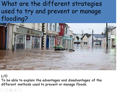
Rivers today are often controlled by human management. This is done mainly to control flow rates and erosion, to create storage and transfer potential as well as to prevent flooding. River management is generally classified into hard and soft engineering.
Hard engineering is large scale construction big and expensive and tries to prevent flooding
Soft Engineering is a more natural way to reduce the impact of flooding, with less intervention and more environmentally friendly methods
Hard engineering is large scale construction big and expensive and tries to prevent flooding
Soft Engineering is a more natural way to reduce the impact of flooding, with less intervention and more environmentally friendly methods
|
|
|

|

Class worksheet
|
Hard vs Soft engineering
With thanks to Hareley12
|
|

Click link to go to GIS Zone
